

225Uploads
23k+Views
6k+Downloads
All resources

KS3 unit - MAP SKILLS - L1 intro to geography
To formulate a definition of Geography
To explain the difference between human and physical geography
fully resourced lesson


KS3 unit - MAP SKILLS L3 - intro to maps
What are maps?
What are map projections?
What do you know about Europe?
Do you know the UK?
fully resourced lesson

KS3 unit - MAP SKILLS - L6 scale
To identify what scale is and why it is used.
fully resourced lesson

KS3 unit - MAP SKILLS - L5 - direction
To identify all 8 points of the compass rose and use direction to navigate your way around a map.
fully resourced lesson
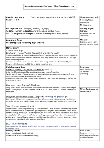
KS3 unit - MAP SKILLS - L4 map symbols
What are map symbols and why are they helpful
fully resourced lesson

KS3 unit - LANDSCAPES - L8 - waterfalls
To describe and explain how rivers shape our landscape and form waterfalls
fully resourced unit
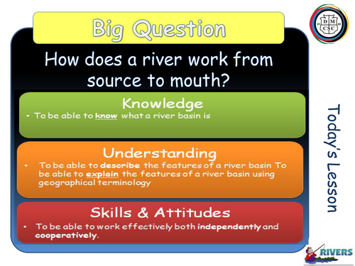
KS3 unit - LANDSCAPES - L6 - river and drainage basins
to be able to describe and explain features of a river basin
fully resourced lesson

KS3 unit - LANDSCAPES - L5 the water cycle
To describe the processes in the water cycle
fully resourced lesson
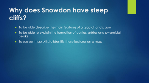
KS3 unit - LANDSCAPES - L10 - glacial landforms
To be able describe the main features of a glacial landscape
To be able to explain the formation of corries, arêtes and pyramidal peaks
To use our map skills to identify these features on a map
fully resourced lesson


KS3 unit - MAP SKILLS - L7 - 4 figure grid references
To know what a grid reference is and
To know the rule ‘along the corridor and up the stairs’
fully resourced lesson

KS3 unit - LANDSCAPES - L9 - glaciation
To investigate the location of ice.
To examine the erosional processes associated with glaciation.
To explore the glacial system.
fully resourced lesson
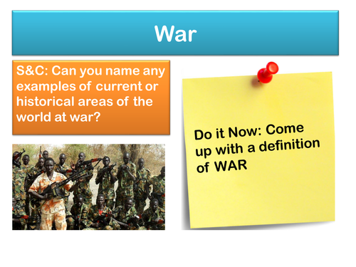
KS3 unit - DEVELOPMENT - L13 conflict in Sudan
to understand the causes and impact of conflict in Sudan

KS3 unit - DEVELOPMENT - L12 assessment
an SDME style assessment focussing on solutions to conflict in Sudan
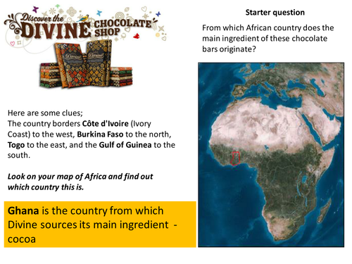
KS3 unit - DEVELOPMENT - L10 trade in Ghana
To identify resources which Ghana trades with the rest of the world.
To describe the role of Ghana’s workers in the cocoa industry.
To evaluate the benefits of Fair Trade for the farmers of Ghana.

KS3 unit - DEVELOPMENT - L9 - Nigeria
to investigate the development of Nigeria
fully resourced lesson

KS3 unit - DEVELOPMENT - L11 - education in Ghana
To describe the impact of education on the life of a school student in Ghana and compare it with our own life.
To explain the challenges which make it difficult for all children to have a good education in Ghana
To explain how education connects with the other Millennium Development Goals

EDUQAS spec A - unit 2 - L9 - the DTM - fully resourced
To be able to identify the key features of a population pyramid.
To be able to create a population pyramid and analyse it.
To be able to explain how the population structure changes with the stages of DTM.

EDUQAS spec A - unit 2 - L20 London regeneration - fully resourced
Lesson Objectives:
You will understand where the Olympics site is Located
You should know why the East End of London was selected as the Olympic site
You will evaluate the social, economic and environmental impacts of the London Olympics on the East end of London